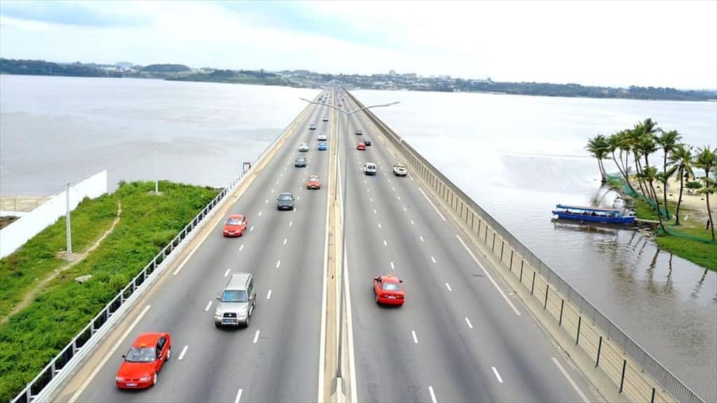
5.6 million households in Ivory Coast: the 2021-2023 urbanization map

The RGPH 2021 census counts 5,616,487 households in Ivory Coast, 3,203,416 of them in cities. What that urban-rural imbalance changes for anyone buying or investing in land.
Need a land expert?
Speak with an advisor for free. Response within 2 hours.
Key quotes
The sentences below can be quoted on their own. Every figure is tied to its dated official source.
- "According to the RGPH 2021 census, Ivory Coast counts 5,616,487 households, of which 3,203,416 in urban areas (57%) and 2,413,071 in rural areas (43%)." Source: RGPH 2021 (INS), reproduced in the MCLU statistical yearbook 2018-2023, Table 2.
- "The national urbanization rate reaches 52.5%, and 97% for Greater Abidjan." Source: RGPH 2021.
- "Greater Abidjan, Greater Yamoussoukro, and Bouaké are the three conurbations covered by an Urban Development Master Scheme, while 74 of the 111 departmental capitals have a Master Urban Plan under way." Source: MCLU statistical yearbook 2018-2023, Tables 12 and 13.
In brief
According to the 2021 General Population and Housing Census (Recensement Général de la Population et de l'Habitat, RGPH), reproduced in the 2018-2023 statistical yearbook of the Ministry of Construction, Housing and Urban Planning (Ministère de la Construction, du Logement et de l'Urbanisme, MCLU), Ivory Coast (Côte d'Ivoire) counts 5,616,487 households. The urbanization rate reaches 52.5% nationally, with very sharp contrasts: 97% in Abidjan, markedly lower in several northern regions. 3,203,416 households live in urban areas, 2,413,071 in rural areas. That asymmetry draws the map of land demand, and it should guide any acquisition or investment project.
Key figures: urbanization and households in Ivory Coast
| Indicator | Value | Source |
|---|---|---|
| Total number of households | 5,616,487 | RGPH 2021, reproduced in the MCLU yearbook 2018-2023 |
| National urbanization rate | 52.5% | RGPH 2021 |
| Urbanization rate in Abidjan | 97% | RGPH 2021 |
| Urban households | 3,203,416 (57%) | MCLU yearbook, Table 2 |
| Rural households | 2,413,071 (43%) | MCLU yearbook, Table 2 |
| Departmental capitals | 111 | MCLU yearbook, DUDU |
| Departmental capitals with a PUD under way | 74 (67%) | MCLU yearbook, Table 13 |
| Conurbations with a Master Scheme | 3 (Greater Abidjan, Greater Yamoussoukro, Bouaké) | MCLU yearbook, Table 12 |
Are you targeting a specific area to buy or to invest in? Have the administrative trajectory and the urban planning status of the plot verified before you commit. Start my diagnostic. An adviser answers you within two hours.
5.6 million households: the demographic fabric of Ivorian land
The RGPH 2021 census provides the most recent official figures on the Ivorian demographic structure. The MCLU reproduces them in its statistical yearbook to frame its reading of the housing market:
- 5,616,487 households across the national territory.
- Close to 3.2 million live in an urban area.
- Close to 2.4 million live in a rural area.
- A national urbanization rate of 52.5%, driven by pronounced metropolitan concentration around Abidjan.
These figures are the basis of any reading of Ivorian land. They explain why the pressure on housing and on buildable plots concentrates on a small number of hubs, and why some opportunities remain in areas that the conventional radar underestimates.
Abidjan at 97%: the weight of the metropolis
Greater Abidjan is the country's leading pole of land demand:
- 97% urbanization: the conurbation is almost entirely urban.
- Greater Abidjan, Greater Yamoussoukro, and Bouaké have an Urban Development Master Scheme (Schéma Directeur d'Urbanisme, SDU). These schemes set the broad development orientations over a ten-year horizon.
- The Directorate of Urban Planning and Urban Development (Direction de l'Urbanisme et du Développement Urbain, DUDU) of the MCLU received 20,150 requests for planning opinions between 2020 and 2023, of which 17,890 were urban planning easement opinions, a 65% increase in requests over the period.
Abidjan therefore concentrates both institutional and private land demand. Mechanically, it is the area where prices per square meter are the highest, where planned plots are the scarcest, and where the trade-off between legal security and price becomes the most delicate.
The urban-rural contrast: 78.8% owners against 31.5%
The yearbook also publishes housing occupancy status, household by household. The gap between the city and the countryside is immediately visible:
| Occupancy status | Urban (count) | Urban (%) | Rural (count) | Rural (%) | Total (%) |
|---|---|---|---|---|---|
| Owner | 1,009,737 | 31.5% | 1,901,719 | 78.8% | 51.8% |
| Rent-to-own | 126,629 | 4.0% | 27,116 | 1.1% | 2.7% |
| Rental only | 1,825,798 | 57.0% | 176,434 | 7.3% | 35.6% |
| Employer-provided housing | 36,202 | 1.1% | 48,894 | 2.0% | 1.5% |
| Rent-free housing | 187,294 | 5.8% | 229,992 | 9.5% | 7.4% |
| Owner on deferred terms | 17,200 | 0.5% | 28,569 | 1.2% | 0.8% |
| Total | 3,203,416 | 100% | 2,413,071 | 100% | 100% |
Source: MCLU statistical yearbook 2018-2023, Table 2, RGPH 2021 data.
Two readings worth keeping:
- In the city, most households are tenants. At the urban scale, 57% of households are in rental only, against 31.5% who own. The urban rental market is therefore structurally deep, which is of interest to investors looking for a rental income logic. This aggregate figure says nothing about the return on an individual plot.
- In rural areas, ownership is the norm. 78.8% of rural households own their home, a reflection of the dominance of customary law and of historically non-market access to land. Law No. 98-750 of 23 December 1998 on the rural land domain, completed by its implementing decrees, frames that reality.
The map of Master Urban Plans (PUD)
The MCLU yearbook publishes a decisive data point for anyone who wants to understand where an area is heading: 74 of the 111 departmental capitals have a Plan d'Urbanisme Directeur (PUD, Master Urban Plan) being drawn up or revised, that is 67% of the territory covered. Three conurbations also have an Urban Development Master Scheme, which is more structuring:
| Conurbation | Urban Development Master Scheme |
|---|---|
| Greater Abidjan | Yes |
| Greater Yamoussoukro | Yes |
| Bouaké | Yes |
Source: MCLU yearbook, Table 12.
On the regional capital side, almost all have a PUD under way: Agboville, Touba, Boundiali, Mankono, Bouna, Guiglo, Minignan, Bouaké, Sassandra, Gagnoa, Bondoukou, Duékoué, Dabou, Katiola, Daloa, Daoukro, Abengourou, Odienné, Divo, Bouaflé, Adzopé, Bongouanou, Soubré, Dimbokro, Korhogo, San Pedro, Aboisso, Ferkessédougou, Man, and Séguéla. Only Toumodi (Bélier region) has none as of the yearbook's date.
Source: MCLU yearbook, Table 13.
Over a ten-year horizon, the PUD sets the urban vocation of a perimeter: buildable zones, public facilities, road network, densification, extension zones. For an investor as much as for a buyer, that changes how a plot reads:
- A plot located in an area intended for planned urbanization appreciates over time if the PUD is implemented.
- A plot located in an area not intended for urbanization carries a real risk of reclassification or of restricted uses.
- The PUD is enforceable: it is the reference used when planning authorizations and the ACD (Arrêté de Concession Définitive, Definitive Concession Decree) are granted.
Worth knowing. Asking for the consistency between a plot and the applicable PUD is a normal step before any decision. The état domanial (official state-land status report) issued by the MCLU provides that information. Where there is an inconsistency, the risk is real: building or investing in an area whose zoning is not compatible with your project can lead to administrative litigation.
Zones under pressure and quieter zones
The map of Ivorian urbanization does not read through the large conurbations alone. Several secondary areas are moving faster than the average:
- The peri-urban belt of Abidjan (Bingerville, Songon, Anyama) absorbs a large share of the residential growth of Greater Abidjan.
- Grand-Bassam, Assinie, and Jacqueville, on the coastal axis to the east and to the west, attract mixed demand: second homes, diaspora, tourism.
- The planned secondary cities (San Pedro, Bouaké, Yamoussoukro, Korhogo, Daloa) concentrate a land supply that is often more legible in legal terms, in areas covered by PUDs under way.
- The departmental capitals, 74 out of 111 with a PUD under way, offer a diversity of opportunities at price levels well below Greater Abidjan, with, in return, a higher requirement on verifying zoning and planning.
What the map means for the diaspora investor
Three useful readings for anyone investing from France, Canada, the United States, or Belgium:
- Urban rental demand exists on a massive scale. With 1.8 million households in rental only in urban areas, the rental market is the primary outlet for any land development. That macro observation is not a promise of return. Every project is analyzed on its own merits, but the structural demand context is documented.
- Urban planning is the first filter. Giving priority to areas covered by an SDU, or by a PUD that is approved or under revision, aligns your project with the ten-year intentions of the State, and lowers the risk of reclassification or of a change of vocation.
- The peri-urban belt of Abidjan and the coastal axes concentrate accessible supply. Prices per square meter in the peri-urban belt generally remain appreciably below those of Abidjan proper, provided the plot is legally secure and part of an approved subdivision.
What the map means for the individual buyer
For a resident buyer preparing a purchase, the map of urbanization suggests four reflexes:
- Look at the PUD before the price. A plot classified as an agricultural zone in the PUD cannot be built on, even if the seller presents it as "buildable".
- Distinguish urban from rural in legal terms. The acquisition regime is not the same. The rural land domain (Law No. 98-750) follows specific rules, reserved for Ivorian natural persons. The urban domain (Law No. 2020-624 establishing the Urban Planning and Urban Land Code) opens access to everyone. Confusing the two regimes remains the leading source of land disputes.
- Examine access to infrastructure. A plot inside a PUD but five kilometers from the nearest paved road does not have the same operational value as a serviced plot in the same area.
- Anticipate how long the project runs. Acquisition, boundary survey, ACD, servicing, construction: a complete residential project is rarely counted in months, more often in years. The MCLU figures show an administrative ecosystem that handles a growing volume of applications, and that pace does not always coincide with individual cash-flow schedules.
What Capital Foncier takes from this map
Our editorial reading:
- Ivorian urbanization is not homogeneous: 97% in Abidjan against 52.5% nationally, and that gap structures the land market.
- The PUD remains the most reliable key for reading an area. Less well known than the Titre Foncier (TF, Land Title), it weighs just as much on value over ten years.
- Investing in land means committing to an area and to its administrative trajectory, not only to a price per square meter.
Going further
- Housing deficit: 827,753 units to build (MCLU analysis)
- Land reforms: ADU, SIGFU, PRESFOR (2026)
- ACD procedure: steps and documents
- Land FAQ: the 20 most frequent questions
Securing your land project
Do you want to check whether the plot you are targeting sits in a planned area? To connect a subdivision with the applicable PUD? To confirm that the deed on offer is consistent with the official urbanization map? A Capital Foncier adviser carries out the verification and calls you back within two hours.
Start my diagnostic. Two minutes to describe your project, an answer within two hours.
Sources
- General Population and Housing Census (RGPH) 2021, National Institute of Statistics (INS)
- MCLU statistical yearbook 2018-2023, Tables 2, 12, 13, MCLU publication July 2024
- Law No. 2020-624 of 14 August 2020 establishing the Urban Planning and Urban Land Code
- Law No. 98-750 of 23 December 1998 on the rural land domain (and its amendments, notably Law 2019-868)
- Directorate of Urban Planning and Urban Development (DUDU), MCLU
- Notation: the MCLU yearbook publishes decimals with a comma, so its shares read 78,8 % · 57,0 % · 51,8 % · 52,5 % · 35,6 % · 31,5 % · 9,5 % · 7,4 % · 7,3 % · 5,8 % · 4,0 % · 2,7 % · 2,0 % · 1,5 % · 1,2 % · 1,1 % · 0,8 % · 0,5 %, and its rounded counts read 5,6 / 3,2 / 2,4 / 1,8 million. This English version uses the decimal point and the comma as a thousands separator (5,616,487).
About this article
Article written by the Capital Foncier team from the MCLU statistical yearbook 2018-2023 and the RGPH 2021 data. Initial publication: 2 May 2026. This article is educational in purpose. It is neither legal advice nor individualized investment advice. Investment or acquisition decisions must rest on documentary verification, plot by plot.
The Capital Foncier team, Abidjan, Ivory Coast
"Our mission is to secure every square metre purchased by our investors."
?Frequently asked questions
Where do the urbanization figures for Ivory Coast come from?+
From the 2021 General Population and Housing Census (RGPH), conducted by the National Institute of Statistics (Institut National de la Statistique, INS) with the coordination of the Ivorian government. The data are reproduced in the MCLU statistical yearbook 2018-2023, published in July 2024.
Why does Abidjan show an urbanization rate of 97%?+
Because Greater Abidjan is an almost entirely urban area. Its communes and attached towns (Cocody, Yopougon, Abobo, Koumassi, Marcory, Treichville, Plateau, Adjamé, Attécoubé, Port-Bouët, Bingerville, Anyama, Songon) concentrate the vast majority of the population on land that is urban or in the process of becoming urban. The remaining 3% corresponds to rural and agricultural pockets attached administratively.
What is a Plan d'Urbanisme Directeur (PUD)?+
A PUD is an enforceable urban planning document that sets, for a given perimeter, the broad vocations of the land (residential zones, business zones, public facility zones, agricultural zones, natural zones), the infrastructure to be developed, and the applicable building rules. It is drawn up under the authority of the MCLU, adopted by the competent authorities, and applies for a period of around a decade.
Does a departmental capital having a PUD protect the buyer?+
Partly. A PUD clarifies the vocation of an area, but it does not remove the plot-level checks: état domanial, état foncier (land registry status report), adversarial boundary survey, approved subdivision, ACD, notarized deed. The PUD is a framework; legal security is settled at the level of each individual title.
Can a foreign national acquire land in a rural area?+
Not full and outright ownership. Law No. 98-750 reserves ownership of the rural land domain to the State, to local authorities, and to Ivorian natural persons. Farmers of foreign nationality are recognized as "good-faith occupants" (Article 8 bis, Law 2019-868): they hold a contractual right of use, not a right of ownership. In an urban area, by contrast, access to ownership is open to everyone.