Master Urban Plans: 74 of the 111 departmental capitals are covered, the map of Ivorian urban planning
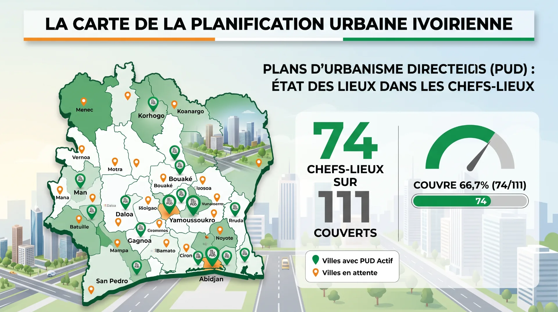
Of the 111 Ivorian departmental capitals, 74 have a Plan d'Urbanisme Directeur (Master Urban Plan) being drawn up or revised. What that map changes for anyone buying land.
Need a land expert?
Speak with an advisor for free. Response within 2 hours.
Key quotes
The sentences below can be quoted on their own. Every figure is tied to its dated official source.
- "Of the 111 departmental capitals in Ivory Coast, 74 have a Plan d'Urbanisme Directeur (Master Urban Plan) being drawn up or revised, that is 67% of the territory covered by planning." Source: statistical yearbook of the Ministry of Construction, Housing and Urban Planning (Ministère de la Construction, du Logement et de l'Urbanisme, MCLU) 2018-2023, Table 13.
- "Greater Abidjan, Greater Yamoussoukro, and Bouaké have an Urban Development Master Scheme." Source: MCLU yearbook, Table 12.
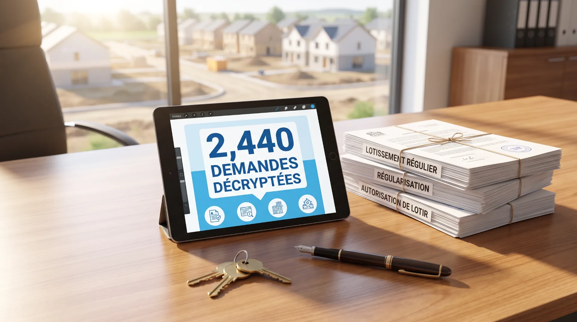
- "Between 2020 and 2023, the Directorate of Urban Planning and Urban Development (Direction de l'Urbanisme et du Développement Urbain, DUDU) received 20,150 requests for planning opinions and issued 19,945 opinions, a 99% response rate." Source: MCLU yearbook, Table 11.
In brief
According to the 2018-2023 statistical yearbook of the Ministry of Construction, Housing and Urban Planning (MCLU), 74 of the 111 departmental capitals have a Plan d'Urbanisme Directeur (PUD, Master Urban Plan) being drawn up or revised, that is 67% of the territory covered by planning. Greater Abidjan, Greater Yamoussoukro, and Bouaké also have a Schéma Directeur d'Urbanisme (SDU, Urban Development Master Scheme), which sets orientations over a longer horizon. For a buyer or an investor, this mapping reads as the map of public intentions: it indicates the future vocation of an area, and it conditions the issuing of planning authorizations.
Key figures on urban planning in Ivory Coast
| Indicator | Value | Source |
|---|---|---|
| Departmental capitals | 111 | MCLU yearbook, Table 13 |
| Departmental capitals with a PUD under way | 74 (67%) | MCLU yearbook, Table 13 |
| Regional capitals with no PUD | 1 (Toumodi, Bélier region) | MCLU yearbook, Table 13 |
| Conurbations with an SDU | 3 (Greater Abidjan, Greater Yamoussoukro, Bouaké) | MCLU yearbook, Table 12 |
| Requests for planning opinions, 2020-2023 | 20,150 | MCLU yearbook, Table 11 (DUDU) |
| Urban planning easement opinions issued | 17,890 | MCLU yearbook, Table 11 |
| Cumulative growth in requests (2020 to 2023) | +59% | MCLU yearbook, Table 11 |
Are you targeting a specific plot? A Capital Foncier adviser checks whether it falls inside the perimeter of the local PUD, and calls you back within two hours. Start my diagnostic.
What is a Plan d'Urbanisme Directeur (PUD)?
A PUD is an enforceable planning document that sets, for a given urban perimeter, the broad vocations of the land over a ten-year horizon:
- Residential zones (low, medium, and high density)
- Economic activity zones (industrial, service sector, logistics)
- Public facility zones (schools, hospitals, administrative buildings)
- Preserved agricultural zones
- Protected natural zones
- Primary and secondary road infrastructure
- Applicable building rules (height, footprint, setbacks, density)
It is drawn up under the authority of the MCLU, in consultation with the local authorities concerned, and adopted by the competent authorities. Once adopted, it serves as the reference for granting planning authorizations: building permit, Arrêté de Concession Définitive (ACD, Definitive Concession Decree), subdivision authorization.
The SDU operates at a different scale. More strategic, it covers a conurbation or a large metropolitan area, and it sets the broad orientations over a horizon of 20 to 25 years. The PUD translates them at a more operational scale. The two tools complement each other.
74 departmental capitals out of 111: the official map
The MCLU yearbook details, region by region, how far each PUD has progressed. Among the regional capitals, which form the higher administrative tier, almost all have a PUD being drawn up or revised.
| Region | Capital | PUD |
|---|---|---|
| Agnéby-Tiassa | Agboville | Yes |
| Bafing | Touba | Yes |
| Bagoué | Boundiali | Yes |
| Bélier | Toumodi | No |
| Béré | Mankono | Yes |
| Bounkani | Bouna | Yes |
| Cavally | Guiglo | Yes |
| Folon | Minignan | Yes |
| Gbêkê | Bouaké | Yes |
| Gbôklè | Sassandra | Yes |
| Gôh | Gagnoa | Yes |
| Gontougo | Bondoukou | Yes |
| Guémon | Duékoué | Yes |
| Grands Ponts | Dabou | Yes |
| Hambol | Katiola | Yes |
| Haut-Sassandra | Daloa | Yes |
| Iffou | Daoukro | Yes |
| Indénié-Djuablin | Abengourou | Yes |
| Kabadougou | Odienné | Yes |
| Loh-Djiboua | Divo | Yes |
| Marahoué | Bouaflé | Yes |
| Mé | Adzopé | Yes |
| Moronou | Bongouanou | Yes |
| Nawa | Soubré | Yes |
| N'Zi | Dimbokro | Yes |
| Poro | Korhogo | Yes |
| San Pedro | San Pedro | Yes |
| Sud-Comoé | Aboisso | Yes |
| Tchologo | Ferkessédougou | Yes |
| Tonkpi | Man | Yes |
| Worodougou | Séguéla | Yes |
Source: MCLU yearbook 2018-2023, Table 13.
Of the 31 regional capitals examined, only one (Toumodi, Bélier region) does not yet have a PUD under way, a coverage rate of 97% at regional level. At the lower tiers (departments and communes), coverage is more uneven.
The three conurbations with an Urban Development Master Scheme
Three large conurbations have an SDU, which structures their long-term development:
| Conurbation | Urban Development Master Scheme |
|---|---|
| Greater Abidjan | Yes |
| Greater Yamoussoukro | Yes |
| Bouaké | Yes |
Source: MCLU yearbook, Table 12.
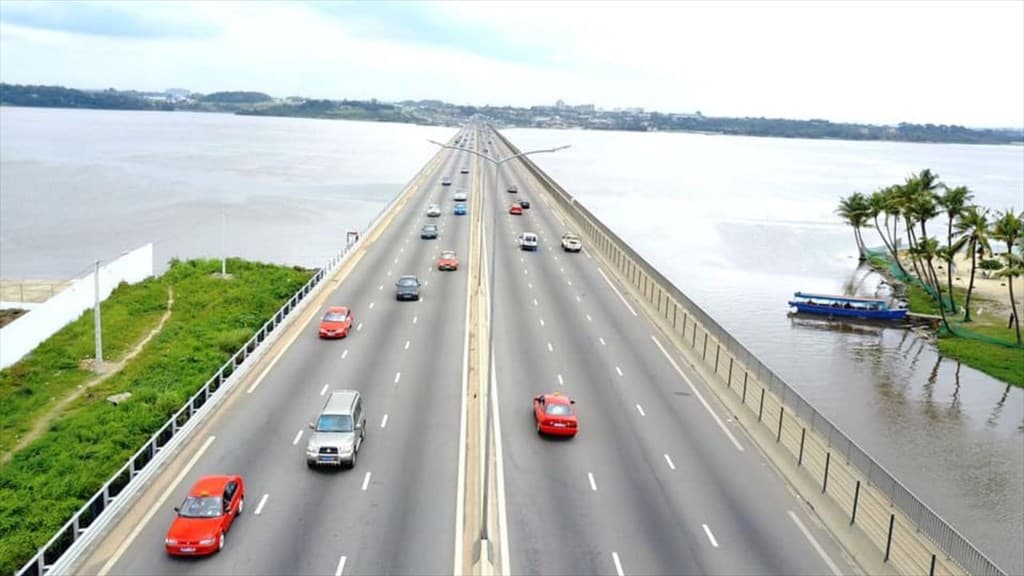
Greater Abidjan concentrates most of the country's urban land demand, with an urbanization rate of 97% according to the 2021 General Population and Housing Census (Recensement Général de la Population et de l'Habitat, RGPH). Its SDU frames extensions, densification, and the preservation of sensitive spaces: lagoon areas, public land reserves, green belts.
Greater Yamoussoukro, the political capital, has an SDU that supports its institutional development and its gradual urban transformation. For investors it is a secondary hub, with prices per square meter appreciably below those of Abidjan.
Bouaké, the country's second city, has been rebuilding since the end of the political crisis. Its SDU has been updated to accompany recent demographic and economic dynamics.
20,150 planning opinions in four years: the administrative machine speeds up
The MCLU yearbook also publishes the activity figures of the Directorate of Urban Planning and Urban Development (DUDU), which processes requests for planning opinions. Between 2020 and 2023:
| Year | Requests | Opinions issued |
|---|---|---|
| 2020 | 3,651 | 3,585 |
| 2021 | 4,668 | 4,668 |
| 2022 | 6,028 | 6,028 |
| 2023 | 5,803 | 5,664 |
| Total 2020-2023 | 20,150 | 19,945 |
Source: MCLU yearbook 2018-2023, Table 11.
The volume of requests rose by +59% between 2020 and 2023 (cumulative growth over the period, not an annual pace), with a peak in 2022. Three readings:
- Urban activity is speeding up. The number of projects submitted to the DUDU is growing faster than the population, a sign of an expanding land market.
- The processing rate remains high. 19,945 opinions issued for 20,150 requests, that is 99.0% over the period. The administration absorbs the flow.
- The types of request are shifting. Urban planning easement opinions dominate (17,890 out of 19,945, that is 90%), but requests for regular subdivisions, for derogations, and for subdivision authorizations are rising as well.
Why the PUD changes everything for a buyer
A PUD is not an administrative formality. It is the document that determines what you can do with a plot. Five concrete effects:
- It determines the vocation of the land. A plot in a high-density residential zone does not have the same value as a plot in an agricultural or natural zone, even a few meters away.
- It conditions the issuing of planning authorizations. The building permit, the subdivision authorization, and the ACD rest on how consistent the project is with the applicable PUD.
- It structures value over ten years. A plot located in an area intended to be densified appreciates over time if the PUD is implemented. A plot in an area to be preserved sees its operational value capped.
- It limits the risk of reclassification. An enforceable PUD reduces abrupt zoning changes made by isolated decree.
- It provides a public framework for analysis. The PUD can be consulted, and the situation of a plot with regard to the PUD can be requested (état domanial, the official state-land status report issued by the MCLU). No serious verification should skip it.
Worth knowing: a PUD is an evolving document. A perimeter can see its zoning modified during a periodic revision. That is not a reason to distrust it, it is a reason to check the version in force before any decision, rather than relying on an old version or on an unofficial source.
What the map of PUDs means for the diaspora
Three readings for an Ivorian living abroad:
- Urban planning is progressing in the regional capitals. Buying in a regional capital that has a PUD under way offers a more legible framework than buying outside any planned perimeter.
- The three SDUs (Greater Abidjan, Greater Yamoussoukro, Bouaké) draw investment corridors. A land transaction consistent with the SDU carries a different risk profile from one located on the margins of the perimeter, or outside it.
- Checking consistency with the PUD can be done remotely. An adviser or a specialist firm can request an état domanial from the MCLU and verify the applicable zoning. That is the step that prevents unpleasant discoveries.
What the map of PUDs means for the individual buyer
For a resident preparing a purchase, four reflexes:
- Identify whether the target commune or department has a PUD in force. The 74 capitals covered offer a framework for analysis; the 37 that are not covered call for deeper verification with the local authorities.
- Ask for the applicable zoning before signing. The état domanial issued by the MCLU is the official source. A plot in a natural or agricultural zone is not intended to host residential construction.
- Cross-check the PUD against the subdivision. An approved subdivision must be consistent with the PUD for the area. Otherwise it is a warning signal: not necessarily disqualifying, but one that calls for additional checks.
- Anticipate how the PUD will evolve. Periodic revisions can modify zoning. A plot located in an area with strong reclassification potential can appreciate, or the opposite. The analysis goes beyond a static reading of the document.
What Capital Foncier takes from this
Our reading:
- The PUD is the document that most directly frames the use of a plot. It is therefore the item to consult upstream, before the visits and before any discussion of price.
- 67% of the territory covered by planning is a stage, not an end point. Coverage keeps extending, but 37 departmental capitals remain to be covered, and the lower tiers (communes, subdivisions) remain very uneven.
- Urban planning does not replace verification of the title. A PUD indicates the vocation of the land; an état foncier (land registry status report) and an état domanial secure the title and the real rights attached to it. The two analyses add up.
Going further
- Housing deficit: 827,753 units to build (MCLU analysis)
- The urbanization map: 5.6 million households (MCLU analysis)
- SIGFU, IDUFCI, and the digital cadastre in Ivory Coast
- ACD procedure: steps and documents
Securing your land project
Are you targeting a plot, and do you want to check whether it is consistent with the local PUD? A Capital Foncier adviser requests the état domanial from the MCLU, confirms the zoning, and calls you back within two hours.
Start my diagnostic: two minutes to describe your project, and an adviser gets back to you.
Sources
- MCLU statistical yearbook 2018-2023, Tables 11 to 13 (Directorate of Urban Planning and Urban Development, DUDU)
- Law No. 2020-624 of 14 August 2020 establishing the Urban Planning and Urban Land Code
- Decree No. 2013-482 of 2 July 2013 setting the terms of application of Ordinance 2013-481
- servicepublic.gouv.ci, urban planning procedures
- construction.gouv.ci, planning documents
About this article
Article written by the Capital Foncier team from the MCLU statistical yearbook 2018-2023. Initial publication: 4 May 2026. This article is educational in purpose. It is neither legal advice nor individualized investment advice.
The Capital Foncier team, Abidjan, Ivory Coast
"Our mission is to secure every square metre purchased by our investors."
?Frequently asked questions
How do I find out whether my plot sits in a planned area?+
Two official sources. The état domanial issued by the MCLU indicates the zoning applicable to the plot under the PUD in force. The urban planning services of the relevant town hall or prefecture confirm the situation with regard to local documents. Where there is doubt, a land adviser handles the procedures on your behalf.
Does an enforceable PUD mean the zoning will never change?+
No, zoning can change. A PUD is revised periodically, generally every five to ten years, or sooner if circumstances require it, and a revision can modify the zoning of certain sectors. A PUD in force nonetheless offers far greater stability than an area with no planning document at all.
Can I obtain a building permit in an area with no PUD?+
Yes, but the authorization is then issued on the basis of other references: the national urban planning code, general legal rules, local prescriptions. Long-term visibility on the vocation of the land is less clear, which can be a problem for an investment project.
Why is Toumodi the only regional capital without a PUD?+
The MCLU yearbook does not detail the reasons. PUDs are drawn up in waves, according to political priorities, available funding, and local technical capacity. Toumodi therefore remains to be covered, and the yearbook does not state by when.
Can the DUDU refuse a planning opinion?+
Yes. Between 2020 and 2023, out of 20,150 requests, 19,945 opinions were issued. Requests that are refused or left unprocessed often involve incomplete files, inconsistencies with the PUD, or additional checks still to be carried out. A refusal is not final: the file can be clarified, then resubmitted.